|
GEO Exploration Limited (AIM: GEO) is pleased to confirm that the fixed-wing magnetic and radiometric survey at the Gorge Project was completed during the course of last week by MAGSPEC Airborne Surveys Pty Ltd.
The survey data will be used to support a litho-structural geological interpretation of the project area and will provide an important input into ongoing drill targeting and the design of proposed geochemical survey programmes.
The Company's Exploration Manager, Tom Harris, is currently onsite undertaking field reconnaissance activities, including validation of historical workings, geological mapping and assessment of priority areas identified from historical exploration data.
Omar Ahmad, Chief Executive Officer of GEO Exploration Limited, commented
"We are pleased with the continued progress being made at Gorge, with the airborne magnetic and radiometric survey now completed ahead of schedule and field reconnaissance activities still underway on site.
Momentum is clearly building across the project. The completion of this survey represents an important step in refining our geological understanding of Gorge and will assist in prioritising targets for follow-up geochemistry and drilling.
With Tom Harris on-site leading field activities, we are moving quickly and methodically through the planned exploration work programme. We look forward to updating shareholders as the results of this work are received and interpreted."
Gorge Project Overview
The Gorge Project (Exploration Licence E08/3737), located approximately 110km west of Paraburdoo in Western Australia, covers an area of 81 square kilometres within the Proterozoic aged Capricorn Orogen. GEO recently acquired the licence, through its 100% owned subsidiary Gorge Gold Pty Ltd. The Gorge project is considered highly prospective for large scale gold systems of Orogenic-type or Carlin-type.
Limited historical exploration at Gorge has identified widespread gold mineralisation across the licence area. Gold occurrences have been recorded over approximately 5km of strike, supported by drainage, soil and rock chip sampling, historic workings, and alluvial and eluvial gold mining.
Historical results include:
· Rock chip samples returning gold values up to 134g/t Au
· Soil samples returning gold values up to 233g/t Au
· Drainage sampling returning elevated gold values
· Recovery of multiple gold nuggets from near surface, ranging from <2g to in excess of 100g
These results along with the proximity of the nugget recoveries suggests the potential presence of a primary bedrock gold source within the licence area.
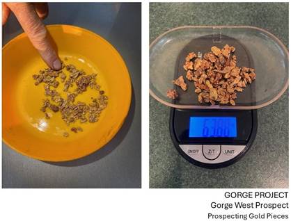
Figure 1 - Gorge West Prospect. Historic Examples of Gold Nuggets Collected from Near Surface
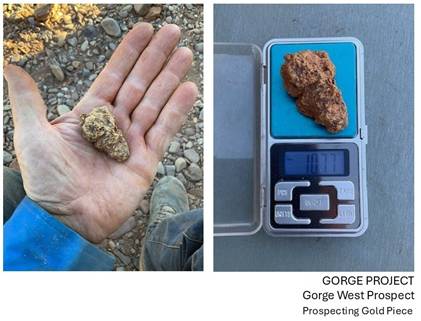
Figure 2 - Gorge West Prospect. Historic Gold Nugget Collected from Near Surface
|